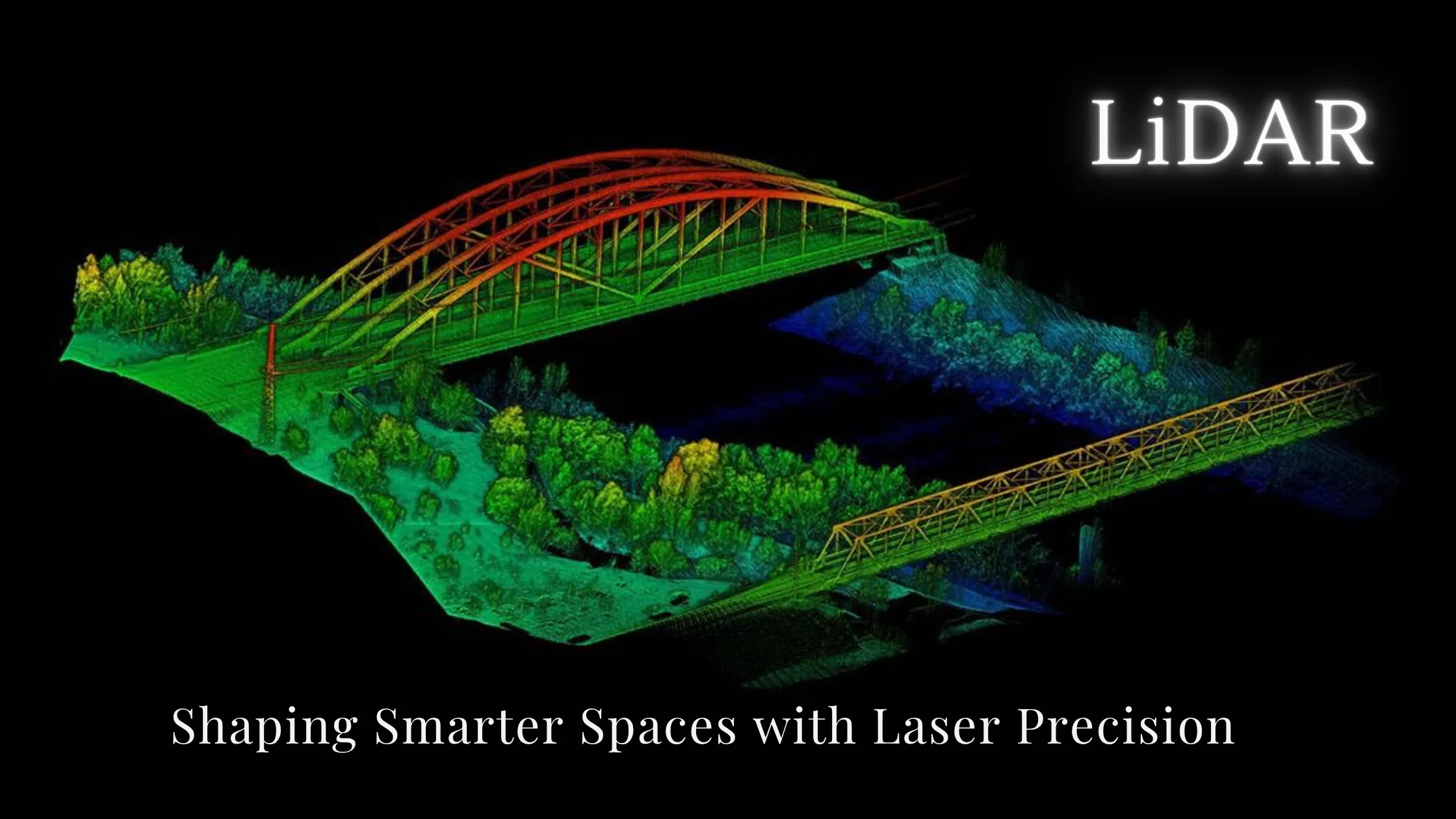
LiDAR — short for Light Detection and Ranging — is a laser-based technology that measures distances and creates precise 3D models of physical environments by emitting laser pulses and timing how long they take to return after hitting a surface. The result is a point cloud: millions of tiny dots that represent the shape and structure of objects, terrain and landscapes with centimetre-level accuracy.
In the modern educational landscape, especially in geoinformatics, LiDAR is rapidly gaining importance. From universities to technical institutions, it is becoming a core component of spatial science education. Whether you're a student beginning your journey in geospatial studies or an educator planning a practical syllabus, understanding LiDAR is essential. This guide explains what LiDAR is, how it works, why it matters, and how students can gain hands-on experience with it.
LiDAR (Light Detection and Ranging) is a laser-based system used to measure distances and create 3D models of physical environments. It works by emitting rapid laser pulses and measuring the time it takes each pulse to reflect back from a surface. This information generates precise spatial data in the form of point clouds.
In simple terms, LiDAR is like giving computers a way to "see" the world in 3D. It is a form of active remote sensing — it emits its own energy rather than relying on sunlight, so it works day and night. Read our complete guide to remote sensing to understand where LiDAR fits in the bigger picture. For a quick visual explanation, watch this brief video introduction to LiDAR.
Students studying geoinformatics use this technology to create detailed models of buildings, landscapes, roads, forests and more.
The academic value of LiDAR lies in its real-world utility and multidisciplinary applications. In-demand skillset: companies in urban planning, infrastructure, environmental science and smart cities are actively seeking LiDAR-literate graduates. Practical learning: LiDAR offers hands-on experience in field surveying, data analysis, GIS integration and 3D modelling. Cross-disciplinary relevance: it is useful in geography, civil engineering, forestry, archaeology, hydrology and disaster management. Research-driven education: students can use LiDAR for mini-projects, theses and real-world research on terrain, land use and structural analysis.
A LiDAR system has four components:
| Component | What it does |
|---|---|
| Laser scanner | Emits rapid light pulses toward a surface |
| GPS receiver | Records the exact position of the system |
| Inertial Navigation System (INS) | Measures the orientation and motion of the platform |
| Software | Processes the return signals and creates 3D maps |
The workflow in an educational context: (1) Data collection using drones, ground scanners or vehicle-mounted sensors; (2) Point cloud generation — millions of x, y, z data points are collected; (3) Data processing using tools like ArcGIS, QGIS or Cloud Compare; (4) Analysis and visualization — creating models, measuring elevation, slope, volume or structure.
This process teaches students a complete cycle — from data capture to spatial analysis — making LiDAR a practical tool in geoinformatics education.
LiDAR is no longer an "advanced" topic; it is becoming a foundational tool in geospatial education. Surveying and geodesy: students learn how LiDAR compares to traditional surveying and practice creating high-accuracy topographic maps. Digital terrain modelling: they build Digital Elevation Models (DEM) and Digital Surface Models (DSM) to analyse landscapes and plan infrastructure. Urban planning: LiDAR data simulates urban growth, optimizes land use, and models transportation networks. GIS integration: students work with LiDAR in ArcGIS or QGIS for feature extraction, classification and elevation profiling. Environmental applications: mapping vegetation, measuring biomass, and monitoring land degradation using LiDAR-based point clouds.
Student-friendly platforms that bring LiDAR to life in the classroom: ArcGIS Pro — industry-standard software for integrating LiDAR data into geodatabases and 3D analysis; QGIS with LAStools — free and open-source, perfect for institutions with limited budgets; CloudCompare — interactive 3D point cloud editing, ideal for students; Global Mapper — good for learning basic terrain processing and volume estimation; AutoCAD Civil 3D — useful for civil engineering students analysing terrain for design and construction.
Project-based assignments make learning LiDAR impactful: 3D campus mapping — collect drone LiDAR data across campus and build a detailed 3D model; slope and drainage analysis — analyse terrain to plan optimal drainage channels; tree height and canopy density measurement — quantify forest structure for environmental studies; road condition mapping — mobile LiDAR can help assess potholes and road quality for smart city projects; heritage site documentation — digitally preserve monuments by scanning them with terrestrial LiDAR.
Data size: LiDAR files are large and require good hardware and memory. Complexity: point clouds can be overwhelming at first; learning to filter and classify them is crucial. Cost of hardware: high-end LiDAR scanners may not be accessible, but alternatives like simulated datasets or open-source data exist. Overcoming these challenges prepares students for real-world industry scenarios.
Even without a LiDAR scanner, you can practice with open datasets: USGS Earth Explorer (U.S. regions), OpenTopography, the National Map, ISRO's Bhuvan portal for Indian elevation data, AHN (Netherlands elevation data) and Copernicus Services (EU). Educators can build lab sessions using this free data to help students analyse terrain and land-use scenarios.
As technology evolves, institutions are introducing more AI and automation into LiDAR workflows. Students now learn automated object detection from point clouds, feature extraction using machine learning, real-time 3D modelling for disaster response and smart cities, and drone-based LiDAR for flexible field surveys. The next generation of geoinformatics professionals will need to combine technical skills, analytical thinking and tool proficiency — and LiDAR offers a solid foundation for all three.
LiDAR uses laser pulses to build precise 3D point clouds of terrain, buildings and vegetation, working day and night as an active remote sensing technology. Its four components are the laser scanner, GPS, INS and processing software. It is now a foundational skill in geoinformatics education, applied in surveying, terrain modelling, urban planning, forestry and heritage preservation. Free tools (QGIS, LAStools, CloudCompare) and open datasets (USGS, OpenTopography, Bhuvan) let any student start practicing today — and AI-driven LiDAR workflows are where the field is heading.
LiDAR is no longer a niche technology — it's a core component of modern spatial science. For students, it offers a hands-on way to understand terrain, infrastructure and spatial change with unmatched accuracy and clarity. By learning LiDAR, students not only become proficient in one of the most powerful geospatial tools — they open doors to careers in urban planning, civil engineering, environment, agriculture, forestry and emerging smart technologies.
The future of geoinformatics is 3D, and LiDAR is the key to unlocking it.
Want hands-on LiDAR and GIS training? Explore NIGMT Foundation's certification and diploma programs in Geoinformatics in New Delhi — offline, online and hybrid modes. Visit our Courses page or call +91-8585991286.