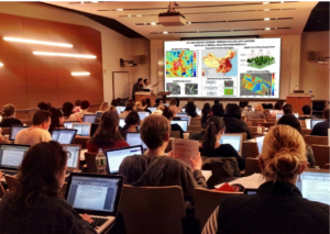
Dual P.G. Diploma in Geoinformatics
Get dual-certified in Geoinformatics — earn both a University P.G. Diploma and an Industry-Approved Professional Diploma in one powerful program. 80–85% practical training | Live...
Read More
Corporate Training Program
Customized geospatial technology training for organizations and working professionals — delivered in-person at NIGMT's campus, online, or in hybrid mode. GIS, Remote Sensing, LiDAR, Photogrammetry...
Read More
6 Months Diploma In Geoinformatics
Fast-track your career in GIS & Remote Sensing — 6 months, 4 technologies, live projects, 100% placement support.
Read More
3 Months Professional Certification in GIS & RS
Master GIS & Remote Sensing in just 3 months — intensive practical training, 1 month live project, 100% placement assistance.
Read More

3 Months Certification Program in (GIS & LiDAR)
Master GIS & LiDAR technology in 90 days — precision terrain modelling, 3D point cloud processing, live project training, 100% placement assistance.
Read More
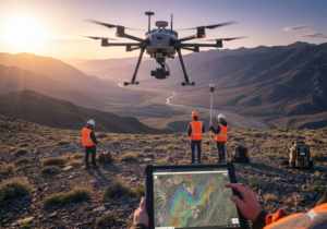
3 Months Certification Program in (GIS & Drone Advance Program)
Master GIS & Advanced Drone Technology in 90 days — UAV operations, drone data processing, live project training, 100% placement assistance.
Read More

3 Months Certification Program in (Advance GIS+ Python)
Master Advanced GIS & Python programming in 90 days — spatial automation, geospatial scripting, live project training, 100% placement assistance.
Read More

3 Months Certification Program 2 Technologies (GIS & Digital Photogrammetry)
Master GIS & Digital Photogrammetry in just 3 months — hands-on practical labs, 1 month live project, 100% placement assistance.
Read More
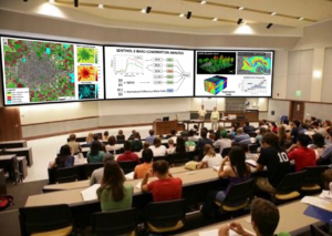
1 Year PGP Diploma in Geoinformatics
Geoinformatics is a science of 'what is where. This one-year program by NIGMT Foundation equips graduates with advanced geospatial skills — from satellite image analysis...
Read More

1 Week Certification in Drone DGCA Certification
Get DGCA-ready in 1 week — drone regulations, airspace rules, safety protocols, and pilot fundamentals. India's legal framework for professional drone operations. 10th pass eligible.
Read More
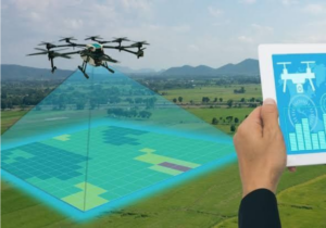
1 Month Certification Program in Drone Data Processing
Master drone data processing in 1 month — orthomosaics, DEMs, point clouds, 3D models, and GIS integration. 70–80% practical training, flexible mode, industry-standard software.
Read More

1 Month Certification Program Any 1 Technology (GIS / RS / PHT) (LiDAR / Surveying)
Choose your specialisation — GIS / Remote Sensing / Photogrammetry / LiDAR / Surveying — and get job-ready in 1 month. 70–80% practical training, customized...
Read More
🎓P.G. Diploma in RS & GIS (1 Year – LMS Program)
Build and deploy a few Nodejs, MongoDB & Expressjs apps while watching to lectures by the author of 9 books on JS/Node.
Read More
🎓P.G. Diploma in RS & GIS (1 Year – Full Time)
Photography Masterclass: Your Complete Guide to Photography. The Best Selling Online Professional Photography Class: How to Take & Sell Photos.
Read More

🎓P.G. Diploma in Geoinformatics (1 Year – Full Time)
A WordPress LMS Plugin to create WordPress Learning Management System. Turn your WP to LMS WordPress with Courses, Lessons, Quizzes & more.
Read More

🎓P.G. Diploma in Geoinformatics (1 Year – Full Time)
Sass is completely compatible with all versions of CSS. We take this compatibility seriously, so that you can seamlessly use any available CSS libraries.
Read More

🎓M.Sc in Geoinformatics (2 Years – Full Time)
Lorem Ipsum is simply dummy text of the printing and typesetting industry. Lorem Ipsum has been the industry's standard dummy text ever since the 1500s,...
Read More

🎓M.Sc in Geoinformatics (2 Years – Campus Program)
Photography Masterclass: Your Complete Guide to Photography. The Best Selling Online Professional Photography Class: How to Take & Sell Photos.
Read More
🎓M.Sc in Geoinformatics (1 Years – LMS Program)
Interchange now enables HTML partials for device specific content. Smoother animations and transitions happen with hardware acceleration. The default styles are all updated.
Read More

🎓 M.Tech in Remote Sensing (2 Years – Campus Program)
In this course, We'll learn how to create websites by structuring and styling your pages with HTML and CSS.
Read More
🎓 M.Sc in Geoinformatics (2 Years – Full Time)
(GIS & Remote Sensing Technology) 🔹 Program Highlights: Coverage of advanced geospatial technologies 80–85% practical, hands-on training Live interactive classes with recording access Research-oriented and...
Read More
🎓 M.Sc in Geoinformatics (1 Year – Lateral Entry)
(GIS & Remote Sensing Technology) 📍 Eligibility: Candidates who have completed a Diploma in Geoinformatics can apply. In-depth learning of modern geospatial technologies 80–85% focus...
Read More

P.G. Diploma in Geoinformatics (1 Year – Full Time)
The jQuery team knows all about cross-browser issues, and they have written this knowledge into the jQuery library. jQuery will run exactly the same in...
Read More

P.G. Diploma in Drone Technology (1 Year – Part Time)
This tutorial will introduce you to PHP, a server-side scripting language you can use to make dynamic websites and web applications.
Read More
M.Tech in Remote Sensing (3 Years – Part Time Program)
Many of the most powerful, memorable and effective photographs are black and white images. With digital photography though you can no longer take a great...
Read More