6 Months Diploma In Geoinformatics
Fast-track your career in GIS & Remote Sensing — 6 months, 4 technologies, live projects, 100% placement support.

Overview
6MP GIS & Remote Sensing Technology
The Six Months Professional Diploma in Geoinformatics is a fast-track, industry-focused program covering 4 advanced geospatial technologies — with 4 months of comprehensive classroom training followed by 2 months of live project experience. Designed for post-graduates and working professionals who want to enter the geospatial industry quickly with job-ready, practical skills and 100% placement support.
Why Choose This Program?
The Six Months Diploma is specifically designed for those who want to enter the geospatial industry without spending a full year. The curriculum is compressed and industry-aligned — covering the most in-demand technologies, with the final 2 months entirely dedicated to working on real-world, live geospatial projects under expert mentorship.
Program Structure
| Phase | Duration | Focus |
|---|---|---|
| Phase 1 — Core Training | 4 Months | Theory + Practical Labs in 4 Geospatial Technologies |
| Phase 2 — Live Project | 2 Months | Real Industry Projects, Portfolio Building, Placement Prep |
| Total Duration | 6 Months | Job-Ready Professional Diploma |
What You’ll Build (Live Project Section)
During the final 2 months, students work on actual client or research projects such as:
- Land Use / Land Cover Mapping
- Crop Health Monitoring using Satellite Data
- Urban Expansion Analysis
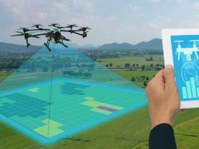
- Topographic Survey & DEM Generation using Drone Data
Program Highlights —
- 🗺️ 4 Advanced Geospatial Technologies
- 🎓 4 Months Comprehensive Classroom Training
- 🔬 2 Months Live Project Training
- 🏗️ Real Industry Project Experience
- 📜 Professional Diploma Certificate
- 🤝 100% Placement Support
Career Opportunities
- GIS Technician / Analyst
- Remote Sensing Data Processor
- Drone Survey Operator & Data Analyst
- Spatial Data Entry & QC Specialist
- Field Survey Coordinator
- Geospatial Project Associate
Program Schedule & Fees
| Mode | Fee | Schedule |
|---|---|---|
| 🏛️ Campus – Offline | ₹71,000* | Monday to Friday |
| 💻 Online – Live | ₹51,000* | Flexible / Recordings Available |
| 🔀 Hybrid | ₹65,000* | Combined Campus + Online |
Hiring Sectors: Urban Planning, Agriculture, Infrastructure, Defence, Environment, Smart Cities, Mining
📍 Ideal For: Post Graduates, and working professionals who want to quickly build strong technical skills and start a successful career in GIS, Remote Sensing, and Geospatial Technologies.
Course Features
- Duration 350 Hours
- Activities Professtional Certification Program
- Time Daily Three Hours
- Day of week Monday to Friday
Instructor
You May Like
Corporate Training Program
Customized geospatial technology training for organizations and working professionals — delivered in-person at NIGMT's campus, online, or in hybrid mode. GIS, Remote Sensing, LiDAR, Photogrammetry...

1 Week Certification in Drone DGCA Certification
Get DGCA-ready in 1 week — drone regulations, airspace rules, safety protocols, and pilot fundamentals. India's legal framework for professional drone operations. 10th pass eligible.
- Days of Week: Monday to Friday
1 Month Certification Program in Drone Data Processing
Master drone data processing in 1 month — orthomosaics, DEMs, point clouds, 3D models, and GIS integration. 70–80% practical training, flexible mode, industry-standard software.
- Days of Week: Monday to Friday

3 Months Certification Program in (Advance GIS+ Python)
Master Advanced GIS & Python programming in 90 days — spatial automation, geospatial scripting, live project training, 100% placement assistance.
- Time: Daily Three Hours
- Days of Week: Monday to Friday

3 Months Certification Program in (GIS & Drone Advance Program)
Master GIS & Advanced Drone Technology in 90 days — UAV operations, drone data processing, live project training, 100% placement assistance.
- Time: Daily Three Hours
- Days of Week: Monday to Friday

Course Features
- Lecture 0
- Quiz 0
- Duration 350 Hours
- Skill level All levels
- Language English
- Students 0
- Assessments Yes