1 Year PGP Diploma in Geoinformatics
Geoinformatics is a science of ‘what is where. This one-year program by NIGMT Foundation equips graduates with advanced geospatial skills — from satellite image analysis to GIS-based decision making — bridging the gap between academics and industry through live project training.

Overview
(GIS & Remote Sensing Technology)
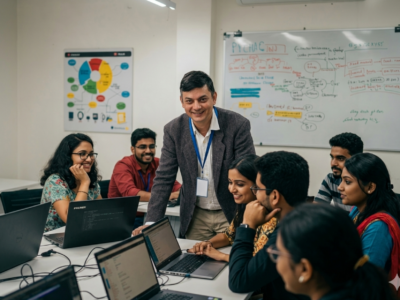
Transform your career with India’s most industry-integrated Geoinformatics program. This one-year Post Graduate Professional Diploma covers GIS, Remote Sensing, GPS, UAV/Drone mapping, LiDAR, Digital Photogrammetry and Web GIS / Python — with 80–85% hands-on training, live project experience, and 100% placement support. Ideal for graduates ready to enter the fast-growing geospatial industry.
🔹 The 8 Geospatial Technologies Covered:
- GIS
- Remote Sensing & Satellite Image Processing
- GPS / Navigation
- Digital Photogrammetry
- LiDAR Technology
- UAV / Drone Mapping
- Google Earth Engine (GEE)
- Web GIS / Python
Career Opportunities
GIS Analyst, Remote Sensing Specialist, Spatial Data Scientist, Cartographer, UAV Survey Expert, Urban Planner, Disaster Management Analyst — with roles in Government, Defence, Smart Cities, Agriculture, and Environmental sectors.
📍 Ideal For: Graduates & Post Graduates and working professionals who want to quickly build strong technical skills and start a successful career in GIS, Remote Sensing, and Geospatial Technologies.
Course Features
- Duration 700 Hours
- Activities Professtional Certification Program
- Day of week 5
Instructor
You May Like
🎓P.G. Diploma in RS & GIS (1 Year – LMS Program)
Build and deploy a few Nodejs, MongoDB & Expressjs apps while watching to lectures by the author of 9 books on JS/Node.
🎓M.Sc in Geoinformatics (2 Years – Full Time)
Lorem Ipsum is simply dummy text of the printing and typesetting industry. Lorem Ipsum has been the industry's standard dummy text ever since the 1500s,...
🎓M.Sc in Geoinformatics (1 Years – LMS Program)
Interchange now enables HTML partials for device specific content. Smoother animations and transitions happen with hardware acceleration. The default styles are all updated.

Course Features
- Lecture 0
- Quiz 0
- Duration 700 Hours
- Skill level All levels
- Language English
- Students 300
- Assessments Yes