Author: admin
Global Positioning System
GPS, or the Global Positioning System, is a global navigation satellite system that provides location, velocity and time synchronization. GPS is everywhere. You can find GPS systems in your car, your smartphone and your watch.
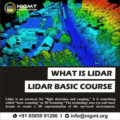
What is Lidar
Lidar is an acronym for “light detection and ranging.” It is sometimes called “laser scanning” or “3D scanning.” The technology uses eye-safe laser beams to create a 3D representation of the surveyed environment.
IIT Roorkee Alumni, having apt In Innovations.
IIT Roorkee Alumni, having apt In Innovations. M Tech, Photogrammetry and Remote Sensing. 24 Years of experience and Headed R&D Unit of largest Photogrammetric Unit of India. Life Time Membership of Indian Society of Remote Sensing and Photogrammetry.
Main Challenge for Geo-Spatial industry is to search and preserve ground water. If any war will happen in future it will be for water. The next challenge is for sustainable development with minimizing carbon footprint. With the advent of UAV, it has open more opportunity to map the world from lower altitude and as on when we require, which has opened lots of possibilities for geospatial analysis. With the advent of putting DGPS on drones, had also opened a lots of opportunities to eliminate traditional survey it is better and faster than conventional methods. Lots of research is going throughout world to improve capabilities of unmanned drones to solve innumerable problems across different segments and also to give better edge for military intelligence. Introducing AI in drones, will also open world of new opportunities, which are not thinkable today.
Geographical Intelligence Engine (GIE)
GIS helps for Pixel to intelligence
Artificial Intelligence depends on a variety of information’s and Geoinformatics gives a Platform to integrate these data in database format. Geographical intelligence is a spatial intelligence that always helps for planning and execution because we observe the human activity on earth by using GIS. GIE is a process of deriving the information geographically by using AI and ML.
Information related to Health, Education, Transport, climate, etc is always most commonly used in our daily life which is required for planning and decision making in our day to day task. Without Right information AI doesn’t work, off course by using Different models, Python, search engine and other programming Language is helping for AI but still, so many things are required to make it simple for the common man. In this Digital era Information is GOD because its playing Significant role in our Daily life but we have to maintain the Preciseness of information otherwise planning can be disaster.
Geographical Intelligence Engine (GIE)
GIS helps for Pixel to intelligence
Artificial Intelligence depends on variety of information’s and Geoinformatics gives Platform to integrate these data in database format. Data as Transport, Climate, Geographical intelligence is a spatial intelligence which always helps for planning and execution
Environmental, Demographic, Health and all other which is required for planning and decision making. Without Right information AI doesn’t work, off course by using Different models, Python, search engine and other programming Language is helping for AI but still so many things are required to make it simple for the common man. In this Digital era Information is GOD because its playing Significant role in our Daily life but we have to maintain the Preciseness of information otherwise planning can be disaster.
Management trainee
Urgent Requirement
Job Role -Management trainee
Location – Delhi,
Send Resume- ravindra.tiwari@nigmt.org
call- 7703828535
Graphics Designer
Max Computer & Typing Institute
Office: Block-I, Plot No. 882-83,
Jahangir Puri, Delhi-110033.
Contact No. 8130394568, 011-27631789
Hello world!
Welcome to WordPress. This is your first post. Edit or delete it, then start writing!
Tuesday Tips: Being Realistic With Your Goals
Lorem ipsum dolor sit amet, consectetur adipisicing elit, sed do eiusmod tempor incididunt ut labore et dolore magna aliqua. Ut enim ad minim veniam, quis nostrud exercitation ullamco laboris nisi ut aliquip ex ea commodo consequat. Duis aute irure dolor in reprehenderit in voluptate velit esse cillum dolore eu fugiat nulla pariatur. Read More “Tuesday Tips: Being Realistic With Your Goals”


